If you were anywhere near Bristol, Somerset or Wiltshire on Monday evening, you’ll have seen it: a wall of cloud building over the South West, lightning flickering on the horizon for hours, and then the full show arriving – torrential rain, cracking thunder and a sky that genuinely looked apocalyptic on satellite imagery.
It wasn’t your imagination. The Met Office recorded 29,074 lightning strikes across the UK in the 24 hours to 9am Tuesday, with the majority – 18,540 strikes – concentrated over Somerset alone. Closer to home, hundreds of properties in Shepton Mallet, Glastonbury and Bristol lost power, Bristol Airport had to close due to an Air Traffic Control fault, and a suspected lightning strike caused a house fire in Emersons Green.
So why, in the middle of one of the hottest weeks the UK has ever recorded, did we also get one of the most violent thunderstorm events in years?
The short answer: heat is the fuel for storms
It feels counterintuitive – surely storms mean a break in the heat? But this is actually a classic setup. Temperatures this week have been pushing toward the UK’s all-time high of 40.3C, recorded in July 2022, with a red extreme heat warning covering an area stretching from London to Swansea and Somerset to Birmingham. That kind of heat doesn’t just sit quietly over the country – it builds up enormous amounts of energy and moisture in the lower atmosphere.
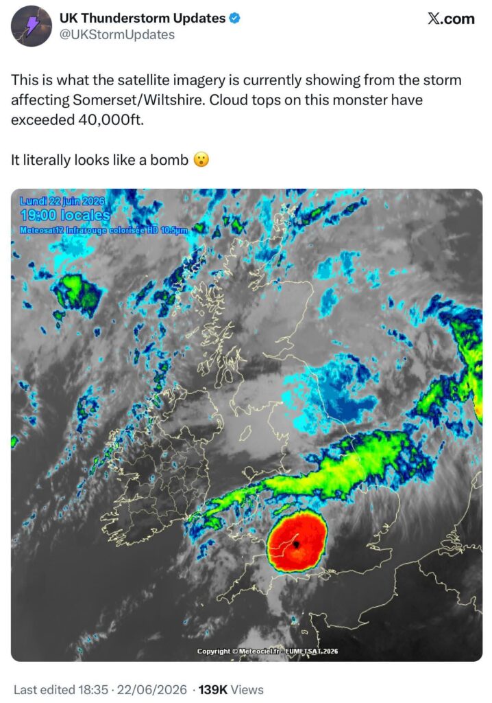
When you get a ‘heat dome’, a large area of high pressure trapping hot air near the surface, the ground heats up intensely day after day. But heat domes rarely stay perfectly stable at the edges. Where that hot, humid air meets cooler air pushing in from the Atlantic or collides with a weak frontal boundary, it gets forced upward violently. Warm air rises fast, cools and condenses – and because there’s so much energy and moisture available, that rising air doesn’t just form clouds, it forms towering cumulonimbus that can punch through 40,000ft in a matter of hours. That’s exactly what satellite imagery showed building over Somerset and Wiltshire on Monday evening – a storm cell so intense it was glowing red-hot on infrared satellite, the signature of an exceptionally tall, exceptionally cold cloud top.
The result is what meteorologists sometimes call “training” storms, cell after cell moving along roughly the same path, dumping huge amounts of rain and producing thousands of lightning strikes in a short window, because the atmosphere has so much fuel to burn through.
Why this matters for anyone monitoring storm risk
Events like this are a good reminder that summer heatwaves in the UK don’t mean a lightning-free few days – often the opposite. Schools across the wider region have already had to adjust opening hours this week, and disruption has hit transport networks too. For sites, events or operations where lightning risk needs to be tracked in real time rather than guessed at, early detection makes a real difference – which is exactly what our lightning and storm detection systems are designed for.